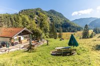
The short, crisp ascent requires sure-footedness and is rewarded with a breathtaking view.


The short, crisp ascent requires sure-footedness and is rewarded with a breathtaking view.
Tour description:
Way: From the Zwing hiking car park, follow the wide, slightly uphill hiking trail no. 5, at the top turn right and take trail no. 28. The first 700 m lead slowly uphill in a westerly direction through the high forest. After the loop in the path, the path climbs steeply and, after further serpentines, reaches the summit cross. The way back is on the same trail. This forest trail requires sure-footedness. Special features: When the weather is good, there is a wonderful view of the Inzell valley and the surrounding mountain ranges. Tip: Do not head straight back in the direction of the exit parking lot. At the bottom of trail no. 28, walk in a westerly direction along the gently sloping, wide forest path to the Wilder Moos (nature reserve). Linger on a bench, let your gaze wander over the nature reserve and go into yourself. Recharge your batteries for everyday life.
Responsible for the content: Inzeller Touristik GmbH

The pasture of short distances. Just a short walk and you can enjoy the Alm atmosphere.
Learn more