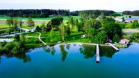
This round with mostly moderate climbs and relaxed descents is ideal for preparing for the summer season.


This round with mostly moderate climbs and relaxed descents is ideal for preparing for the summer season.
Tour description:
Obing - Pittenhart - Pestkapelle - Obing
Direction of travel : Clockwise
Surface : 80% asphalt, 20% good gravel forest road
Uphill : < 2% - > 7%, Downhill: < 9%
Inclinations : -
Note : For handbike beginners, a bike guide or e-support is recommended. Drive tires with profile are recommended.
From the parking lot at Obinger Rathaus, turn left along Kienberger Straße for a short distance and at the hotel/inn "Oberwirt" (with beer garden) turn right along Kienberger Straße (!) to the start of the signposted circular tour .
Past the last houses, the view opens onto green meadows and the first sculptures . After approx. 1.7 km on a good gravel path, the path leads past the copper "art lady" in the reeds, a few meters up the gravel path to the right (approx. 5%) (!) onto Seestraße and then right to Altenmarkter Straße. At the crossroads (!), follow the footpath and cycle path alongside the road to the left in the direction of Altenmarkt, then turn right, cross Altenmarkter Straße at the traffic island (!) and follow the cycle path in the direction of Seeon.
After about 1.5 km, with a view of the distant Alps , this cycle path ends on the right at the junction with the TS21. In the direction of Pittenhart , carefully cross the TS21 to the left side of the road (!) . On a good bike path, it's a pleasurable descent to Pittenhart . At the entrance to the village, the “Alte Zollstation”inn awaits you on the right with a beautiful garden and a wheelchair-accessible toilet . The bike signage in the village center points the way further to the right. Slightly uphill on the forest road in the direction of Obing and the "Pestkapelle". From the end of the village there is a firm sandy path with moderate inclines (> 2% and 180 m descent, max. 9%) to the pretty, yellow "Pestkapelle" at the edge of the path. The "final sprint" leads approx. 300 m on a firm gravel path through the forest up to Obing (between 3% and 7% incline). From the entrance to the town, follow Poststrasse until it meets Wasserburger Strasse. Roll right on the sidewalk to the traffic light intersection Wasserburger-/Kienberger Str. Cross the street and follow Kienberger Straße back to the town hall.
(!): Reference to road crossings or possible problem areas
The tour is signposted throughout. If in doubt, follow the bike signs and the tour logo .
This circular tour is a perfect addition to the Obinger See tour, but is also very well suited as a separate training route.
Wheelchair toilets:
- Obing: in the town hall (during opening hours) and in the “House of Associations” opposite the town hall (with a wall safe with a euro key, access 24 hours a day)
- Pittenhart: "Alte Zollstation" inn www.altezollstation.de
A8 Munich-Salzburg, exit Grabenstätt - Chieming - Seebruck - Seeon - Obing
Start/finish : Obing, town hall car park, Kienberger Straße 5

Opening times: May - September: 9 a.m. - 6 p.m. (with lifeguard) depending on the weather
Learn more